What complex geological process must scientists account for when modeling the true elevation of an ancient shoreline marker after the water disappeared?
Answer
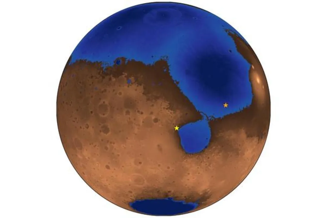
Isostatic adjustment
The weight of the water would depress the crust (isostatic adjustment); subsequent rebound after water loss shifts the original elevation marker, which must be factored into calculations.
Related Questions
What is the scientific term for the possibility that Mars once hosted large bodies of liquid water?Which region of Mars is hypothetically suggested as the location for the ancient ocean, sometimes referred to as *Oceanus Borealis*?What primary surface features observed by orbital missions are cited as evidence for ancient Martian shorelines?Confirming ancient shorelines helps scientists constrain what critical parameters regarding early Mars?According to the geological markers table, which feature requires the strongest evidence of direct interaction with moving surface water?Approximately how long ago is early Mars theorized to have possessed conditions capable of sustaining liquid water on its surface?Which instrument's detailed imaging analysis has occasionally failed to corroborate expected geological signatures of ancient shorelines in targeted areas?Sedimentary layers found in the geological record have been interpreted as deposits laid down by what coastal processes?What characteristic feature would a large, deep ocean leave behind that catastrophic outflow floods would likely not produce consistently?What complex geological process must scientists account for when modeling the true elevation of an ancient shoreline marker after the water disappeared?