Where in the sky does the Sun?
The position of the Sun overhead is anything but static; it is a continuous, predictable dance influenced by our planet’s tilt and orbit. Understanding where it is at any moment requires looking at a couple of key parameters: its altitude above the horizon and its direction along the horizon, known technically as azimuth. From our perspective on Earth, the Sun appears to trace an arc across the sky each day, much like a spotlight moving across a dome. This arc dictates everything from how hot the midday is to when we experience twilight.
# Daily Arc

On a fundamental level, the Sun’s daily motion is dictated by the Earth's rotation. As the Earth spins on its axis, the Sun appears to rise in the east, climb to its highest point near the middle of the day, and then descend toward the west before setting. This cycle defines our day and night. However, describing its position simply as "rising in the east and setting in the west" is an oversimplification that ignores the crucial changes that happen over the course of the year.
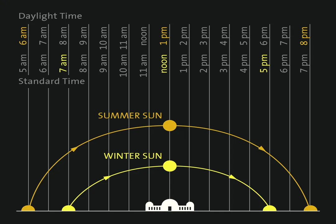
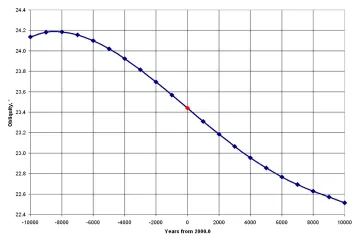
The exact point on the horizon where the Sun rises and sets shifts throughout the year. In the Northern Hemisphere, for example, the Sun rises north of due east and sets north of due west during the summer months, following a longer, higher path across the sky. Conversely, in the winter, its path shortens, and it rises south of east and sets south of west, staying lower in the sky throughout the day. This variation is directly tied to the Earth's axial tilt of approximately 23.5 degrees relative to its orbital plane.
# Seasonal Path
The tilt is the reason we experience seasons, and it is also the primary reason the Sun’s apparent path in the sky changes so dramatically from June to December. When the Northern Hemisphere is tilted toward the Sun, we experience summer. During this time, the Sun reaches its highest annual altitude at solar noon. This higher altitude means the sunlight travels through less of the Earth's atmosphere, resulting in more intense heating—a simple, observable consequence of geometry.
When the Earth continues its orbit and the Northern Hemisphere tilts away, winter sets in. The Sun's path appears lower, scraping closer to the southern horizon for observers in the north. The lowest point in this seasonal variation occurs around the winter solstice, the shortest day of the year, when the Sun never rises very high above the southern horizon. The equinoxes, marking spring and autumn, represent the transition points where the Sun rises due east and sets due west everywhere on Earth, and the day and night lengths are nearly equal.

# Locational Influence
If the Sun's path varies seasonally, it varies even more dramatically depending on where you stand on Earth. Your latitude determines the fundamental geometry of the arc you observe. For instance, someone standing at the Equator (latitude 0°) sees the Sun almost directly overhead twice a year, during the equinoxes. Their daily arc is relatively consistent year-round, always crossing the meridian (the line pointing due south in the Northern Hemisphere, or due north in the Southern Hemisphere) at a high angle.
As you move away from the Equator toward the North or South Pole, the difference between the summer high path and the winter low path becomes extreme. Consider a location deep within the Arctic Circle. In summer, the Sun might never dip below the horizon, resulting in the "midnight sun" phenomenon. Conversely, in the depths of winter, the Sun may remain entirely below the horizon for weeks or months, creating a period of polar night. This highlights that the Sun’s path is not a single, universal curve but a unique visual experience for every point on the globe.
# Measuring Position
To describe the Sun’s position precisely, we use two main angles: altitude and azimuth.
The altitude is the vertical angle measured upwards from the horizon line to the Sun's center. Zero degrees altitude is the horizon itself, and 90 degrees altitude is directly overhead, known as the zenith. Because the Sun reaches its highest point at solar noon, this moment corresponds to the maximum daily altitude achieved. Knowing the altitude is vital for solar energy collection, as the efficiency of a panel is directly related to how close the Sun is to being perfectly perpendicular to its surface.
The azimuth describes the horizontal direction. It is measured as an angle in a circle around the observer, typically starting from North (0° or 360°), increasing clockwise through East (90°), South (180°), and West (270°). The Sun's azimuth changes continuously throughout the day. At sunrise, the azimuth is the easternmost point on the horizon the Sun reaches for that specific date and latitude, and at sunset, it is the westernmost point.
If you are in the Northern Hemisphere, the Sun's azimuth will always be in the southern half of the sky (between 90° and 270°) between sunrise and sunset, except near the summer solstice when it may briefly touch the northeastern and northwestern points.
| Latitude Example | Summer Solstice Noon Altitude (Approx.) | Winter Solstice Noon Altitude (Approx.) | Key Feature |
|---|---|---|---|
| Equator (0°) | ~89° | ~67° | Very little seasonal change in path height. |
| Mid-North (e.g., 40° N) | ~73° | ~26° | Dramatic seasonal shift in path height. |
| Arctic Circle (66.5° N) | >0° (Sun visible 24h) | <0° (Sun below horizon) | Possibility of 24-hour daylight or darkness. |
A practical application of knowing the noon position is simple orientation. If you find the Sun's highest point at local solar noon—which is not necessarily 12:00 PM clock time—that direction points due South in the Northern Hemisphere, regardless of the time of year. This is a reliable method for establishing a north-south line if you can accurately determine when solar noon occurs.
# Calculating Position
Since manually tracking the azimuth and altitude based only on the season and latitude is complex due to the changing Equation of Time (the difference between apparent solar time and mean solar time), specialized calculators have been developed. These tools take into account your precise geographical coordinates (latitude and longitude) and the exact date and time to provide the Sun’s exact location.
These digital aids allow users to input their location and see detailed results, often including not just the current altitude and azimuth, but also the precise times for sunrise, solar noon, and sunset for that day. Some even offer graphical representations, plotting the Sun's path for a specific date directly onto a diagram representing the sky dome for your location. Furthermore, many advanced calculators can model the path for any day of the year, allowing you to look ahead to see how high the Sun will be on a future date, which is highly useful for architectural planning or gardening.
One fascinating output from these precise tools is the concept of the solar zenith angle. This is simply the angle between the Sun and the zenith (the point directly overhead). It is simply 90 degrees minus the altitude. When the zenith angle is zero, the Sun is overhead, as happens near the tropics at noon on certain days. This angle is particularly important in solar energy calculations because maximum irradiance occurs when the zenith angle is minimized.
If you are planning activities that rely on constant sunlight, such as setting up a large solar array or optimizing greenhouse placement, understanding the subtle interplay between longitude and time is key. A common mistake is assuming solar noon aligns with standard time zones. Because time zones cover broad longitudinal strips, a location near the eastern edge of a time zone will experience solar noon earlier than a location on the western edge of the same zone. For instance, two towns just fifty miles apart east-to-west within the same time zone might have their solar noon times differ by fifteen minutes or more, meaning their respective Sun altitudes will peak at different clock times. This difference is critical if you are tracking energy production minute-by-minute.
# Tracking Movement
For observers without access to specialized digital tools, older methods or simplified calculations can offer rough estimates. Historically, observers used gnomons—a simple vertical stick—to measure shadows. The shortest shadow cast during the day always occurs at solar noon, marking the moment of highest altitude. By tracking the shadow's length and direction over time, one could trace the Sun's general movement.
Comparing the Sun's path in the middle latitudes (like much of the US or Europe) with that near the tropics reveals a clear geometric difference. In the mid-latitudes, the Sun’s path is noticeably asymmetric; the period between sunrise and solar noon is often shorter than the period between solar noon and sunset, especially far from the equinoxes. This asymmetry is a direct result of the Equation of Time interacting with the observer's latitude. Near the tropics, while the altitude changes wildly between summer and winter, the path itself often appears more balanced in terms of time spent rising versus setting, when viewed over the course of a whole year, averaging out closer to a 12-hour day. Observing this asymmetry in shadow length during a summer afternoon—where the sun appears to speed up its descent westward—is a tell-tale sign you are far from the equator.
When planning outdoor events or construction where you need to know the exact bearing of the Sun at 4:30 PM on a specific autumn date three months from now, relying on general rules of thumb becomes risky. The precise calculations offered by modern solar position calculators are necessary because they account for the slight variations in Earth's orbit (the Equation of Time) which cause the timing of events like sunrise to drift slightly even if the date stays the same from one year to the next. These tools essentially perform the complex spherical trigonometry required to pinpoint the Sun's location in three dimensions for any moment you specify.
Related Questions
#Citations
SunCalc - sunrise, sunset, shadow length, solar eclipse, sun ...
Calculation of sun's position in the sky for each ... - SunEarthTools.com
Day and Night World Map - Time and Date
Where is The Sun? How to Find The Sun in the Sky - TheSkyLive
Sun & Stars Paths - Southern California's gateway to the cosmos!
Sun path - Wikipedia
Where Does the Sun Rise and Set? - Stanford Solar Center
SunCalc - sun position, sunlight phases, sunrise, sunset, dusk and ...
Sun Direction: orientation of the sun throughout the day